KUMILY - MUNNAR - PALAKKAD
This post should actually come at the end of this series but since I returned through a completely different route (which I regretted partially) I thought for the this is the logical sequence.
I had thought in my mind that I would do the return trip through a different route for two reasons. One was that a trip to Idukki district would be incomplete without visiting the Idukki arch dam and the other reason was that we were returning home so time was not an issue. The problem was that I had two choices.
After Idukki I could go to Kothamangalm and thereon to Angamaly where I could get onto the NH-47 to Palakkad. This I wanted to avoid because the NH-47 is a nightmare for people who enjoy driving. The other option was to go to Adimali from Idukki, get on the NH-49 to reach Munnar. I could then drive through the Chinnar WLS to Udumalapet and Pollachi.
The evening before we left we had some spare time in our hands and decided to explore around Kumily. This took us to Chellarkoil view point, where there was nothing much to view in cloudy weather except beer bottles and cigarette butts thrown by careless picnickers. There was this gentleman there who knew the area well and he suggested that we take the Kumily - Munnar road which according to him was very picturesque. It was then that I realized two days was too less to explore Idukki. Here kilometers were mere numbers. We had to ask distances in time!
16th July, 2012. We were out of the resort at 8.20 after an early breakfast. Kumily was just waking up to a languid Monday morning. Off season, according to the Kashmiri merchant we met on our walk down the streets.
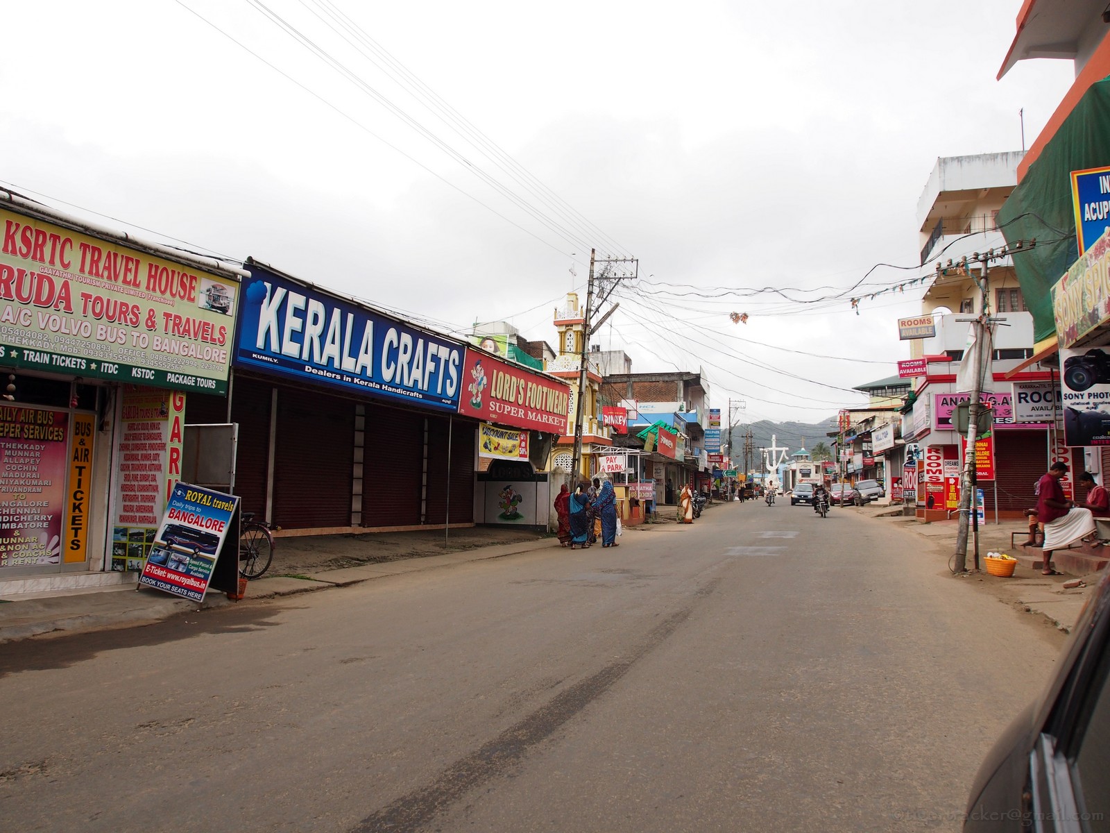
The Munnar road is the one going off up a slope after the bus stand and immediately after the post office (or before these places if you are coming from the Thekkady side of town.

This part of the world is famous for its spices and every other shop in town has a spice counter! The demand for spices is so much that all along the Kumily - Munnar road you have spice shops attached to houses along the road side.

Some 13 kms out of Kumily is Anakara. The Chellarkoil view point is a 5 kms deviation to the right, which I personally didn't find worth a detour. You pass through Vandanmedu (23 kms) to reach Puliyanmala (29 kms). This is where the road to Kattapana splits off to the left. The road is now more narrow and winding as you pass through acres of cardamom that slows the pace considerably.


Kattapana (35kms) is a busy town with many narrow twisting lanes that can confuse. Ask the friendly policeman or auto driver for directions as there are many one ways here. The road widens a bit after Kattapana since it is the highway connecting this town to Kothamangalam. You cross the Idukki arch dam before reaching Cheruthoni. There is a tourist information center & dam view point under construction. It is expected to be ready by the 5th of August. The view of the dam is not really the best from there.


To compensate for the poor view you get some excellent, freshly brewed lemon tea from Khadeeja's little shop opposite this visitors center. She also gives you information about the place as well as divulges her secret of making lemon tea. If the jack-fruit chips are still there, don't forget to try it. It is home made!

Cheruthoni (61 kms) is just a turn on the road. The main highway appears to turn right after the bridge but in realty you have to keep driving up the slope in front of you past long line of autorickshaws.

After about 5 kms you will reach a junction where the highway turns to the right. Bang in the center opposite the divider on the road is a blue signboard that says "Hill View Park" (68kms). The arrow points left but is so faded that it might be missed.

You have to take the left from here to reach the above mentioned park from where you have a view of the reservoir and the two dams. Here also there is a lot of construction work going on for this spot to be readied before the Onam vacation, the time when the dam is accessible to the public. .


The Cheruthoni dam is barely visible but we did not climb all the way to the top of the view point because of all the construction material lying around and the inclement weather.

A better view of the arch dam is from a low bridge just before Kadeeja's tea shop (when you come from Kattapana) but the best view would be from a hairpin bend at the level of the dam, near one of its approach roads. Unfortunately that bend has a number of tea & refreshment shops perched on the edge. If you park your vehicle, you'll be held responsible for causing a traffic jam. Maybe a trip that way early in the morning will be good option.
As I looked through the view finder I was struck by the resemblance of the 'unstained' part of the dam to something familiar. My son took one look and said. "Papa, it looks like my underpants!" I thought it looked like string bikini though.

If you take your eyes off the dam and look around you will see it straddles two hillocks, the Kuravanmala & Kurathimala. The height of the dam is a little over 550 feet making it one of Asias tallest arch dams. Legend has it that Lord Rama got angry with the tribal couple because they were watching Sita bathing. He cursed them to be turned to stone but when they pleaded with him that they had never be separated in their lives he took pity on them and said they would be united forever. The dam, it appears is the result of Sree Rama's blessing!

We were getting late so we decided to move. I had to reach Puliyanmala again before getting onto the Kumily-Munnar Highway. We were back on the highway at Puliyanmala but this detour to the dam was 73 kms and took nearly three hours including stoppage time.
The progress over the next one and a half hours was fast. Nedumkandam (46 kms), Udumbanchola (49 kms), Santhanpara (64 kms)& Poopara (77 kms) come in quick succession. (The distances mentioned hereon are from Kumily, excluding the 73 kms detour to the dam site). It is more of plantations all the way. The only interesting thing is this beautiful church to Velankanni matha (Mary & Infant Jesus) where you can stop for a blessing like I did. Don't forget to make a contribution if you stop by. There are a lot of sign boards that point to 'view point' but those were not the standard DTPC boards and looked like they were put up by private home stay owners to attarct interest. I wasn't too keen on going off roading in my little Punto.


Munnar is only 32 kilometers from Poopara but the narrow twisting road makes driving a slow affair. Enjoy the scenery as you pass by. Look at the cardamom plants, see their roots and learn where this exotic spice comes from.

The other obstacle as you reach Munnar is the fog, which I hadn't accounted for during my research on the route! Once you cross Periakanal, about 20 kms before Munnar the fog rolls in, irrespective of the season. It was nearly 2.00 PM and our tummies were growling. I was getting a bit snappy since the last edible thing I had was Khadeeja's home made jack fruit chips almost 4 hours before. Munnar was still a 45 minute drive away and the fog wasn't making things easy. I was worried that lunch would be closed by the time I got there. Then, through the lifting mist I saw a sight across the valley. Nestled on the side of a rocky outcrop was the Club Mahindra's Lake View resort.


Snappiness was replaced by joy as we reached Chinnkanal, the location of the resort. What a buffet it was? I even managed to smile at the chap who was ringing a bell and walking around with a sign that read "Buffet will close in 10 minutes". He probably wanted us to pack up and leave and we were glad to.

It was a lucky lunch stop because the rest of the 18 kilometers to Munnar was a hide and seek game in the fog. The road would disappear into the fog..........

...............only to appear around the next corner.

Then it would disappear again till you get completely disoriented!

In times like that it is nice to just park your car, get out,close your eyes and enjoy the ghostly veil surrounding you.

After all, there is no fixed agenda. Getting home can wait when you are in bliss!
Munnar (111 kms) is always busy and we had nothing to stop for so we just drove through. After that it is a series of endless neat acres of tea estates shrouded in mist.


Marayoor (152 kms) is the last major stop in the high ranges and famous for its sandal wood forests. It is not unusual to see some friendly gaur cropping grass within the fencing.


5.30 PM we bid goodbye to the beautiful Idukki district as we started our final descent through the Chinnar Wildlife Sanctuary.

The Thoovanam falls were in full flow despite a bad monsoon. I have long overdue trek to its base still pending.


Our long day ended at home in Palakkad (276 kms) at 9.30PM. This route was actually some 20 kilometers shorter than the route I had taken to reach Thekkady, but I had been on the road six hours longer!
Ask me if I was tired, I'll answer with an emphatic 'NO'. I enjoy my driving and I hope to keep at it for many more years to come.
5 comments:
beautiful views R.Q..thanks for the visual treat...
beautiful views R.Q..thanks for the visual treat...
Yeah. It's a beautiful place but needs a strong tummy. The twisty roads are not for the faint hearted!
Munnar the Enchantress.
You guys did a great job spending your time to create this article! If I had to explain my emotions about your website in only one word ? it would be WOW! Thank you! P.S. Subscribed for updates!
Post a Comment