Showing posts with label chinnar. Show all posts

Saturday, September 01, 2012

Misty & Mysterious Munnar - Part 1: The Routes

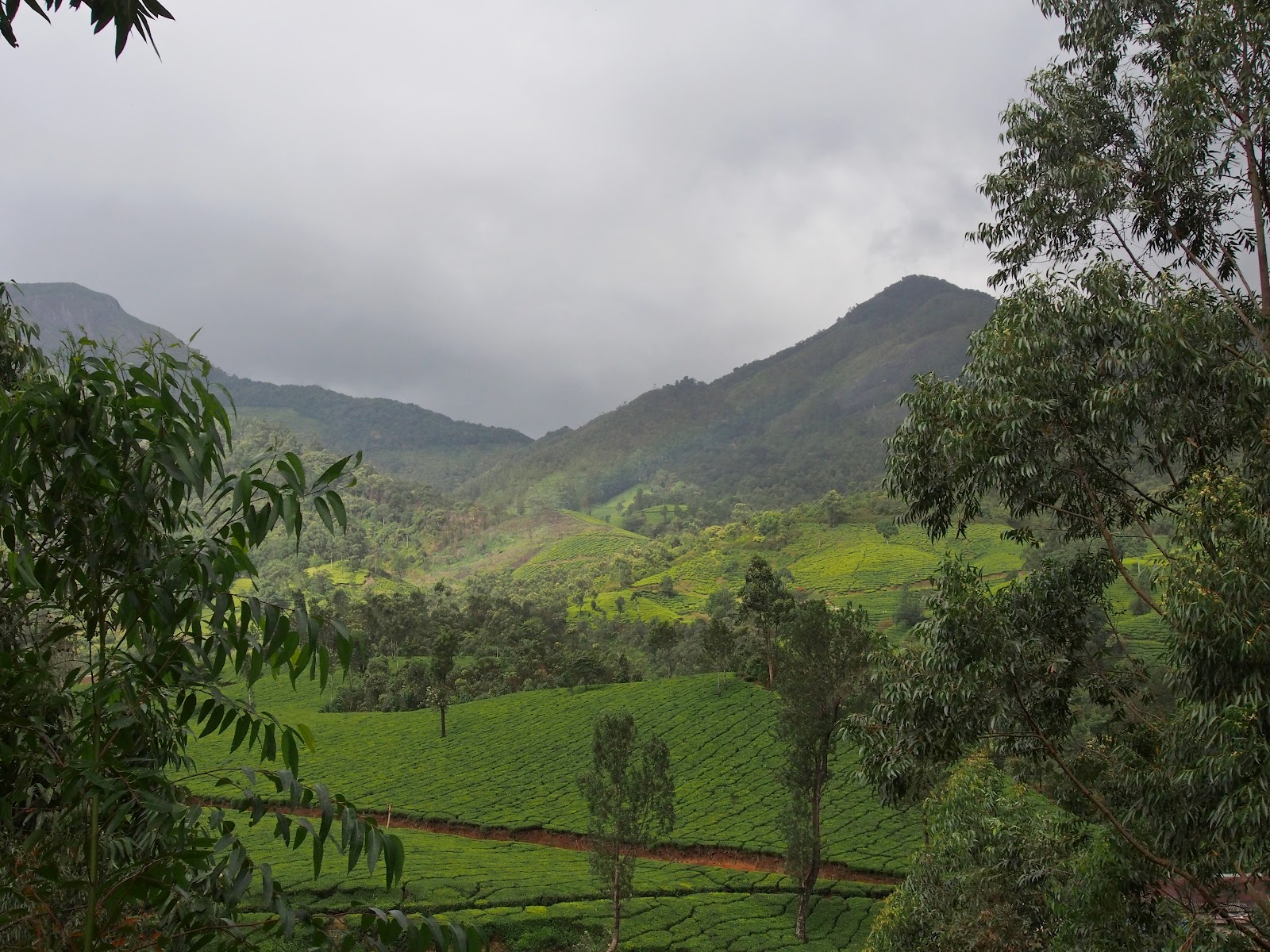
Kerala's claim to being "Gods own Country" is sounds really hollow and unconvincing most often than not. However, there is one part of this highly politicized state that really makes that statement meaningful; Munnar. Munnar is to Kerala like Ooty is to Tamilnadu. Higher altitudes of the Western Ghats with thousands of hectares of beautifully manicured tea plantations.


Since our Bandipur trip was scuttled by the powers that be, we had to think of an instant alternative for the Onam holidays. We had returned from Thekkady through Munnar in July and had not stopped to enjoy it's wild beauty. So we now had an opportunity that came knocking and we grabbed it with both hands.

Access to Munnar from where we live could be through two routes. One route takes you through Kerala on the NH-47 and at Ernakulam you turn into the NH-49 (Cochin-Madurai highway). The other route passes partly through Tamilnadu and re-enters Kerala at the border in Chinnar WLS. No prizes for guessing which route we prefer.

From Palakkad the road to Pollachi branches off to the right at Kootupatha. The road has recently been upgraded and is in excellent condition till Gopalapuram check post at the border.
Looking towards the Kerala side
Don't be fooled by the four-lane like portion just after the check post. It narrows down immediately after you cross the impressive statue of Thiruvalluvar!
Looking toward Tamilnadu side


The next 15 kilometers to Pollachi (Trip distance 48 kms) is full of potholes and it only improves 5 kilometers before the town. At the traffic signal at the bus stand take the right turn to Udumalapet. It is a good for the entire thirty kilometers.

When you reach Udumalapet (Trip distance 77 kms) the road to Munnar is on your right. You can't turn right there so you have to go to the end of the road and take a U-turn and then turn left to Munnar.
Approaching from Pollachi drive to the junction at the end of this road

Make an U-turn and come back to the traffic light for the Munnar road

The part through the town is confusing because a railway overbridge work is lying incomplete for many years now.
Take left here and any right after that

You'll have to take a left through a residential area and reach the Goverment Arts College where you have to turn right and catch the Munnar road, where you have to go left again. I drive by instinct and have never asked for direction but it will be better to stop and ask if you are driving for the first time, especially after dark!

After that it is fairly straight forward till you reach the first major junction where the Munnar road swings left. The road going straight reaches Thirumoorthy dam and the sign board is prominently placed so you can't lose your way.


At Amaravathi nagar (Trip distance 95 kms) you encounter the first in the series of 7 check posts. They rarely stop you at the Police check post but the Forest check post immediately next to it requires that you enter your details before proceeding forward.


This is the entrance to the Anaimalai Tiger Reserve. You are reminded to drive slowly through the forest and you might even rendezvous with a few pachyderms occasionally in one particular part of the stretch.


Single lane traffic throughout the Anaimalai Tiger Reserve. Be careful when you go off the road to allow oncoming traffic. The edge of the road in some places are quite steep and you can do your vehicle some damage. Trucks rarely make way for small vehicles so find a place with a smooth edge and wait for them to pass.


The road is worse in the "elephant" zone (above) and they have put an idiotic sign board along that stretch!! (left). How can you drive fast with so many potholes?!


The next check post is at the Tamilnadu-Kerala border where you are again made to enter your details in a register. Keep a few 10 rupee notes handy as the men at the Tamilnadu forest check posts aren't too shy about asking for a small 'something' especially if you have a non-TN registered vehicle!


Once you cross the bridge into Kerala you have three check posts, the Excise, Forest and Chinnar WLS entry (Trip distance 108 kms). You have to enter your details at the WLS check post again. Next to the check post is the eco-development committee office from where you can arrange treks into the WLS.


The last check post where you have to stop to make an entry is after the sandal forests, 15 km from Marayoor. A little after that is the Lakkom waterfalls, which is worth a small tea break!
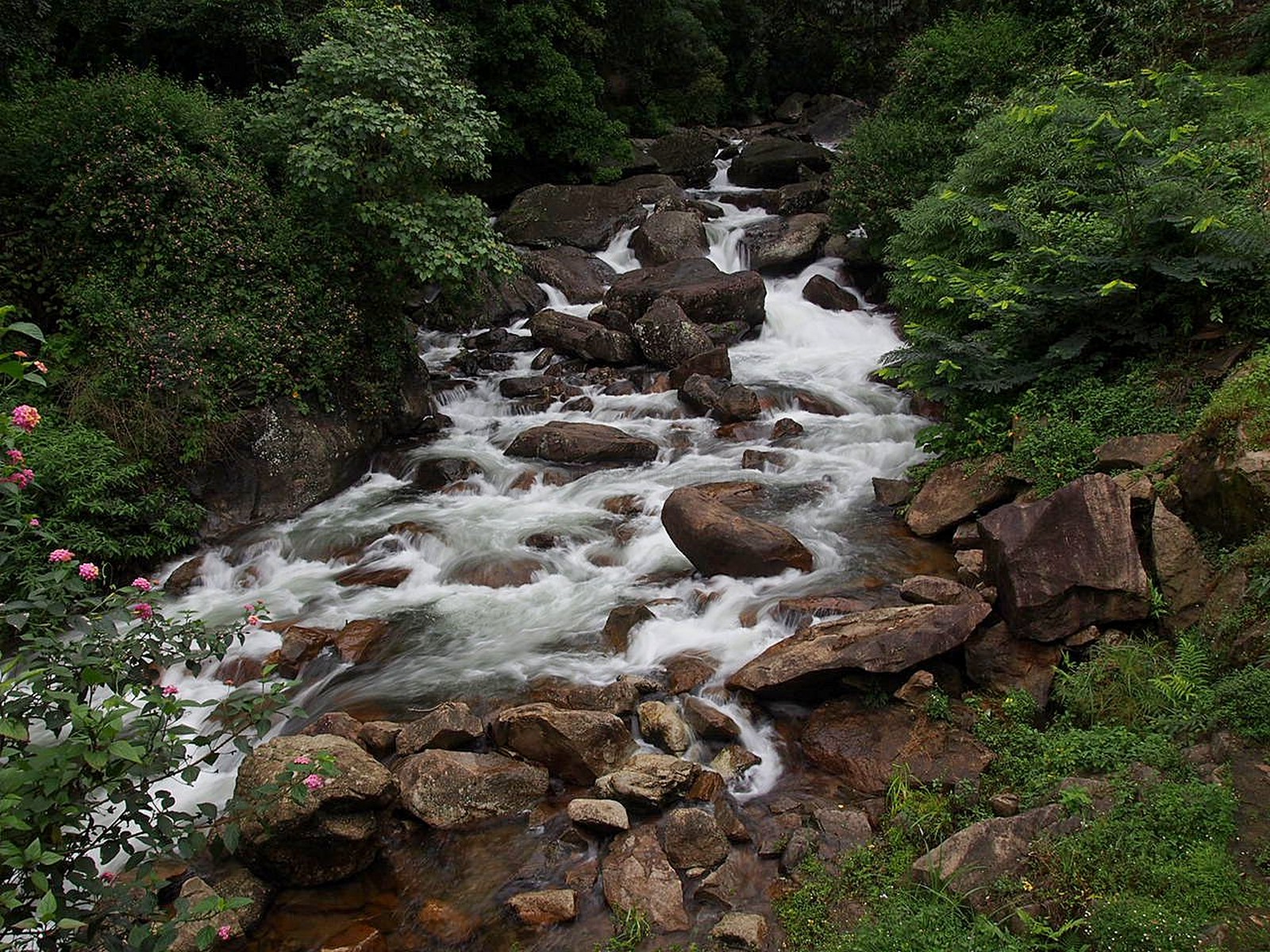
Lakkom falls in full flow
 

Downstream from the falls


The Eravikulam National Park (Trip distance 159 kms) is 35 kilometers from Marayoor and just 12 kilometers from Munnar. You will need to plan a half day trip if you want to have encounter with the Nilgiri Tahr, including the waiting time for the  shuttle buses that take you from the reception center to the park.


The entrance is now crowded with food stall and curio shops that make the traffic jams worse. We reached early enough to be on the first bus trips and avoid the holiday traffic.
The bridge in Munnar from the Chinnakanal road

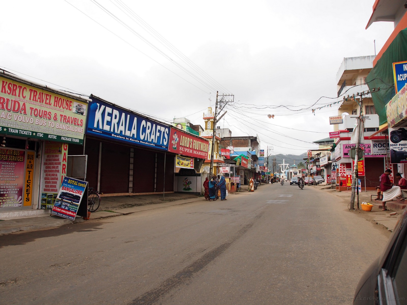
Munnar town (Trip distance 172 kms) itself is very small, wrapped around the confluence of three streams. The road from Marayoor snakes through the main market and reaches a bridge on the left immediately after the IndianOil petrol station. The road running right goes to Adimaly through Pallivasal. You can go to the Idukki arch dam that way. If you take the left across the bridge the road divides at the end of it. The left will take you to Mattupetty, Kundala and Top Station. The right goes to Devikulam, Chinnakanal, Periyakanal and Poopara. From Poopara the left turn goes to Theni & Madurai and the straight road is to Kumily & Thekkady.

If you want to avoid the traffic there is an alternate route from Marayoor, passing through Kanthaloor, Anaimudi Shola, Kundala & Mattupetty. The 8 kilolmeters through tha Anaimudi shola will require a vehicle with good ground clearance. I will tell you about this route in subsequent blog.

I will place the links to the blogs related to each of the places I mention here as I update it....just follow the links as they come along

Thursday, August 30, 2012

Making of a New Woodcrawler

There comes a time in every daddy's mind when you start wondering if your little boy has grown up. I recall a conversation a couple of years in Bandipur with a Canadian tour operator, who was showing my son the photos he'd shot of polar bears while taking his guests on a wilderness tour in his native country. He said, "Don't come when your dad has to bring you; come when you can bring him".

Supreme court seems bent on throwing obstacles on our Bandipur visits for the time being but it gave us to explore some very unique parts of wild  Kerala. We drove 535 kilometers over four days and walked through some beautiful ecosystems which, if Bandipur were accessible, would have never popped up on our scanners! I will go into those experiences shortly but today I'm just a proud father of a son who loves nature as much as I do.

I wasn't sure if a boy, just a couple of months away from his 10th birthday was ready for  Woodcrawling but this trip seemed to have been designed by someone up there to test a 10 year old's resilience.

Day-1: 26th August 2012. Anaimudi Shola National Park
Our stay at Marayoor on that day was with the intention of checking out the famous fruit and vegetable farms of Kanthaloor and a trip to the mid-sized bit of the Shola National Parks here, the Anaimudi Shola. It's not for the faint-hearted especially if you are very "leecho-phobic". My son loves these slimy creatures. He says they have to feed too so there is no harm in contributing a little for the leeches' cause!


Day-2: 27th August, 2012. Eravikulam National Park

The home of the endangered Niligiri Tahr. It is a long climb to where the tahrs graze but it is well worth it. Unlike other national parks there is no restriction on the time you can spend here. We had come up to the reception center many times and gone back because of the crowds. This time the halt in Marayoor ensured that we reached in time for the ticket counter to open. Not surprisingly. this is the bit the little Woodcrawler loved most!


Day-3: 28th August,2012. Pampadum Shola National Park
As usual the timeshare holiday activity department portrays every task so difficult that you tend to think they are so concerned about you. Actually, if you do things on your own, you'll find that you spend ten times less!

We drove off to explore Mattupetty, Kundala and Pampadum Shola. The man at the forest station was skeptical. He said we were here during the wrong season but if we were willing to tolerate the leeches we could go. Someone should tell these guys that leeches are not going to put off a 10 year old waiting to do his third jungle walk in as many days!


Day-4: 29th, August 2012. Chinnar WLS

Last day of our trip saw us spend little time on Lakkom waterfalls between Eravkulam and Marayoor. As we reached Chinnar WLS I remembered I had promised the lady at the Eco-development committee counter that we'd be back to take a trek. It was 2PM but cloudy. I asked my son if he was ready for another walk in the jungle. I shouldn't have asked, because the answer in the affirmative came even before I could complete the question!

As we moved out, Selvam, the guide started off about "an elephant chasing a foreign tourist yesterday". I shut him up before he could narrate the entire episode. I hadn't planned for this walk and my son was in his "Ona-kodi", the new dress for Onam, a bright orange t-shirt, and he was sticking out like a beacon!!


A few minutes into the walk the guide paused in  mid-stride, his stick held up horizontally to tell us to stop. I could smell the elephant (or it's dung). We moved forward cautiously without any uncomfortable encounters with the elusive pachyderm.


The going is stiff in a few places but the little woodcrawler seemed to take it in his stride. With the invisible elephant behind us, he was more comfortable.


There were signs of the gaur and elephant but quite old and it was no deterrent for him. He just kept pace with the guide like a veteran trekker!


He was the first in top of a rock face that had some caves, (more about that later).......


...and while we waited to catch our breath on the very top. The guide went to take some pictures of the caves, and us.


After going to "Point - B", we began our descent. A lone gaur on the way provided the only interesting diversion. The guide was over cautious but then he did not know about our experiences with this large herbivore in Bandipur and other places.


Back at the car, my son showed me his foot. The shoe had scraped the skin off his heel and the blood had soaked into the material. All through the walk he had never complained or protested.

I have every right to be boastfully proud! After all this is what a dad looks forward to. No TV or Playstation for my son, ...

The Woodcrawler Version.2


.

Tuesday, July 24, 2012

The Trial of the Tusker - Periyar Part 2

See previous post here

KUMILY - MUNNAR - PALAKKAD
This post should actually come at the end of this series but since I returned through a completely different  route (which I regretted partially) I thought for the this is the logical sequence.

I had thought in my mind that I would do the return trip through a different route for two reasons. One was that a trip to Idukki district would be incomplete without visiting the Idukki arch dam and the other reason was that we were returning home so time was not an issue. The problem was that I had two choices.

After Idukki I could go to Kothamangalm and thereon to Angamaly where I could get onto the NH-47 to Palakkad. This I wanted to avoid because the NH-47 is a nightmare for people who enjoy driving. The other option was to go to Adimali from Idukki, get on the NH-49 to reach Munnar. I could then drive through the Chinnar WLS to Udumalapet and Pollachi.

The evening before we left we had some spare time in our hands and decided to explore around Kumily. This took us to Chellarkoil view point, where there was nothing much to view in cloudy weather except beer bottles and cigarette butts thrown by careless picnickers. There was this gentleman there who knew the area well and he suggested that we take the Kumily - Munnar road which according to him was very picturesque. It was then that I realized two days was too less to explore Idukki. Here kilometers were mere numbers. We had to ask distances in time! 


16th July, 2012. We were out of the resort at 8.20 after an early breakfast. Kumily was just waking up to a languid Monday morning. Off season, according to the Kashmiri merchant we met on our walk down the streets. 


The Munnar road is the one going off up a slope after the bus stand and immediately after the post office (or before these places if you are coming from the Thekkady side of town.


This part of the world is famous for its spices and every other shop in town has a spice counter! The demand for spices is so much that all along the Kumily - Munnar road you have spice shops attached to houses along the road side.

Some 13 kms out of Kumily is Anakara. The Chellarkoil view point is a 5 kms deviation to the right, which I personally didn't find worth a detour. You pass through Vandanmedu (23 kms) to reach Puliyanmala (29 kms). This is where the road to Kattapana splits off to the left. The road is now more narrow and winding as you pass through acres of cardamom that slows the pace considerably.


Kattapana (35kms) is a busy town with many narrow twisting lanes that can confuse. Ask the friendly policeman or auto driver for directions as there are many one ways here. The road widens a bit after Kattapana since it is the highway connecting this town to Kothamangalam. You cross the Idukki arch dam before reaching Cheruthoni. There is a tourist information center & dam view point under construction. It is expected to be ready by the 5th of August. The view of the dam is not really the best from there. 


To compensate for the poor view you get some excellent, freshly brewed lemon tea from Khadeeja's little shop opposite this visitors center. She also gives you information about the place as well as divulges her secret of making lemon tea. If the jack-fruit chips are still there, don't forget to try it. It is home made!

Cheruthoni (61 kms) is just a turn on the road. The main highway appears to turn right after the bridge but in realty you have to keep driving up the slope in front of you past long line of autorickshaws.

After about 5 kms you will reach a junction where the highway turns to the right. Bang in the center opposite the divider on the road is a blue signboard that says "Hill View Park" (68kms). The arrow points left but is so faded that it might be missed. 


You have to take the left from here to reach the above mentioned park from where you have a view of the reservoir and the two dams. Here also there is a lot of construction work going on for this spot to be readied before the Onam vacation, the time when the dam is accessible to the public. .

The Cheruthoni dam is barely visible but we did not climb all the way to the top of the view point because of all the construction material lying around and the inclement weather.

A better view of the arch dam is from a low bridge just before Kadeeja's tea shop (when you come from Kattapana) but the best view would be from a hairpin bend at the level of the dam, near one of its approach roads. Unfortunately that bend has a number of tea & refreshment shops perched on the edge. If you park your vehicle, you'll be held responsible for causing a traffic jam. Maybe a trip that way early in the morning will be good option.

 As I looked through the view finder I was struck by the resemblance of the 'unstained' part of the dam to something familiar. My son took one look and said. "Papa, it looks like my underpants!" I thought it looked like string bikini though. 
If you take your eyes off the dam and look around you will see it straddles two hillocks, the Kuravanmala & Kurathimala. The height of the dam is a little over 550 feet making it one of Asias tallest arch dams. Legend has it that Lord Rama got angry with the tribal couple because they were watching Sita bathing. He cursed them to be turned to stone but when they pleaded with him that they had never be separated in their lives he took pity on them and said they would be united forever. The dam, it appears is the result of Sree Rama's blessing! 

We were getting late so we decided to move. I had to reach Puliyanmala again before getting onto the Kumily-Munnar Highway. We were back on the highway at Puliyanmala but this detour to the dam was 73 kms and took nearly three hours including stoppage time.

The progress over the next one and a half hours was fast. Nedumkandam (46 kms), Udumbanchola (49 kms), Santhanpara (64 kms)&  Poopara (77 kms) come in quick succession.  (The distances mentioned hereon are from Kumily, excluding the 73 kms detour to the dam site). It is more of plantations all the way. The only interesting thing is this beautiful church to Velankanni matha (Mary & Infant Jesus) where you can stop for a blessing like I did. Don't forget to make a contribution if you stop by. There are a lot of sign boards that point to 'view point' but those were not the standard DTPC boards and looked like they were put up by private home stay owners to attarct interest. I wasn't too keen on going off roading in my little Punto.

The highway to Bodinayakannur and Theni turns right at Poopara and you can easily get misled. The road to Munnar goes straight up but it narrows considerably as tea plantations start making their appearance.

Munnar is only 32 kilometers from Poopara but the narrow twisting road makes driving a slow affair. Enjoy the scenery as you pass by. Look at the cardamom plants, see their roots and learn where this exotic spice comes from.


The other obstacle as you reach Munnar is the fog, which I hadn't accounted for during my research on the route! Once you cross Periakanal, about 20 kms before Munnar the fog rolls in, irrespective of the season. It was nearly 2.00 PM and our tummies were growling. I was getting a bit snappy since the last edible thing I had was Khadeeja's home made jack fruit chips almost 4 hours before. Munnar was still a 45 minute drive away and the fog wasn't making things easy. I was worried that lunch would be closed by the time I got there. Then, through the lifting mist I saw a sight across the valley. Nestled on the side of a rocky outcrop was the Club Mahindra's Lake View resort. 
Snappiness was replaced by joy as we reached Chinnkanal, the location of the resort. What a buffet it was? I even managed to smile at the chap who was ringing a bell and walking around with a sign that read "Buffet will close in 10 minutes". He probably wanted us to pack up and leave and we were glad to. 


It was a lucky lunch stop because the rest of the 18 kilometers to Munnar was a hide and seek game in the fog. The road would disappear into the fog..........


...............only to appear around the next corner.

Then it would disappear again till you get completely disoriented!

In times like that it is nice to just park your car, get out,close your eyes and enjoy the ghostly veil surrounding you. 
After all, there is no fixed agenda. Getting home can wait when you are in bliss!

Munnar (111 kms) is always busy and we had nothing to stop for so we just drove through. After that it is a series of endless neat acres of tea estates shrouded in mist.


Marayoor  (152 kms) is the last major stop in the high ranges and famous for its sandal wood forests. It is not unusual to see some friendly gaur cropping grass within the fencing.


5.30 PM we bid goodbye to the beautiful Idukki district as we started our final descent through the Chinnar Wildlife Sanctuary. 


The Thoovanam falls were in full flow despite a bad monsoon. I have long overdue trek to its base still pending. 


 It is one scene that never fails to enthrall. Darkness fell as we crossed Udumalpet and Pollachi.
Our long day ended at home in Palakkad (276 kms) at 9.30PM. This route was actually some 20 kilometers shorter than the route I had taken to reach Thekkady, but I had been on the road six hours longer!

Ask me if I was tired, I'll answer with an emphatic 'NO'. I enjoy my driving and I hope to keep at it for many more years to come.