Since our Bandipur trip was scuttled by the powers that be, we had to think of an instant alternative for the Onam holidays. We had returned from Thekkady through Munnar in July and had not stopped to enjoy it's wild beauty. So we now had an opportunity that came knocking and we grabbed it with both hands.
Access to Munnar from where we live could be through two routes. One route takes you through Kerala on the NH-47 and at Ernakulam you turn into the NH-49 (Cochin-Madurai highway). The other route passes partly through Tamilnadu and re-enters Kerala at the border in Chinnar WLS. No prizes for guessing which route we prefer.
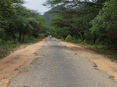
From Palakkad the road to Pollachi branches off to the right at Kootupatha. The road has recently been upgraded and is in excellent condition till Gopalapuram check post at the border.
 |
| Looking towards the Kerala side |
 |
| Looking toward Tamilnadu side |
The next 15 kilometers to Pollachi (Trip distance 48 kms) is full of potholes and it only improves 5 kilometers before the town. At the traffic signal at the bus stand take the right turn to Udumalapet. It is a good for the entire thirty kilometers.
When you reach Udumalapet (Trip distance 77 kms) the road to Munnar is on your right. You can't turn right there so you have to go to the end of the road and take a U-turn and then turn left to Munnar.
 |
| Approaching from Pollachi drive to the junction at the end of this road |
 |
| Make an U-turn and come back to the traffic light for the Munnar road |
The part through the town is confusing because a railway overbridge work is lying incomplete for many years now.
 |
| Take left here and any right after that |
You'll have to take a left through a residential area and reach the Goverment Arts College where you have to turn right and catch the Munnar road, where you have to go left again. I drive by instinct and have never asked for direction but it will be better to stop and ask if you are driving for the first time, especially after dark!
After that it is fairly straight forward till you reach the first major junction where the Munnar road swings left. The road going straight reaches Thirumoorthy dam and the sign board is prominently placed so you can't lose your way.
 |
At Amaravathi nagar (Trip distance 95 kms) you encounter the first in the series of 7 check posts. They rarely stop you at the Police check post but the Forest check post immediately next to it requires that you enter your details before proceeding forward.
This is the entrance to the Anaimalai Tiger Reserve. You are reminded to drive slowly through the forest and you might even rendezvous with a few pachyderms occasionally in one particular part of the stretch.
Single lane traffic throughout the Anaimalai Tiger Reserve. Be careful when you go off the road to allow oncoming traffic. The edge of the road in some places are quite steep and you can do your vehicle some damage. Trucks rarely make way for small vehicles so find a place with a smooth edge and wait for them to pass.
 |
The road is worse in the "elephant" zone (above) and they have put an idiotic sign board along that stretch!! (left). How can you drive fast with so many potholes?!
The next check post is at the Tamilnadu-Kerala border where you are again made to enter your details in a register. Keep a few 10 rupee notes handy as the men at the Tamilnadu forest check posts aren't too shy about asking for a small 'something' especially if you have a non-TN registered vehicle!
Once you cross the bridge into Kerala you have three check posts, the Excise, Forest and Chinnar WLS entry (Trip distance 108 kms). You have to enter your details at the WLS check post again. Next to the check post is the eco-development committee office from where you can arrange treks into the WLS.
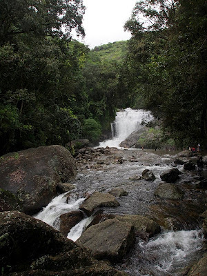
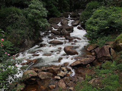
The last check post where you have to stop to make an entry is after the sandal forests, 15 km from Marayoor. A little after that is the Lakkom waterfalls, which is worth a small tea break!
 |
| Lakkom falls in full flow |

 |
| Downstream from the falls |
The Eravikulam National Park (Trip distance 159 kms) is 35 kilometers from Marayoor and just 12 kilometers from Munnar. You will need to plan a half day trip if you want to have encounter with the Nilgiri Tahr, including the waiting time for the shuttle buses that take you from the reception center to the park.
 |
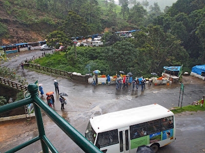
The entrance is now crowded with food stall and curio shops that make the traffic jams worse. We reached early enough to be on the first bus trips and avoid the holiday traffic.
 |
| The bridge in Munnar from the Chinnakanal road |
Munnar town (Trip distance 172 kms) itself is very small, wrapped around the confluence of three streams. The road from Marayoor snakes through the main market and reaches a bridge on the left immediately after the IndianOil petrol station. The road running right goes to Adimaly through Pallivasal. You can go to the Idukki arch dam that way. If you take the left across the bridge the road divides at the end of it. The left will take you to Mattupetty, Kundala and Top Station. The right goes to Devikulam, Chinnakanal, Periyakanal and Poopara. From Poopara the left turn goes to Theni & Madurai and the straight road is to Kumily & Thekkady.
If you want to avoid the traffic there is an alternate route from Marayoor, passing through Kanthaloor, Anaimudi Shola, Kundala & Mattupetty. The 8 kilolmeters through tha Anaimudi shola will require a vehicle with good ground clearance. I will tell you about this route in subsequent blog.
I will place the links to the blogs related to each of the places I mention here as I update it....just follow the links as they come along


3 comments:
INTERESTING DR! Lakkom falls looks so amazing!!
Lakkom is a great place to spent a little time if the rush of tourist are less ;-)
Amazing yet interesting place Munnar....
Post a Comment